Monday, October 15, 2007

The Statistics

Here are the statistics from the Great Mountain Bike Adventure of 2007 (excluding one evening ride around town in Durango where both of our computers' batteries died):

Number of Consecutive Days Riding: 14
Number of Rides: 15
Number of States Ridden In: 3
Total Hours in the Saddle: 35 hours, 46 minutes
Total Miles Ridden: 231.94 miles
Total Elevation Gain (uphill): 27,287 feet
Total Elevation Loss (downhill): 37,749 feet
Highest Elevation: 12,052 feet (top of Santa Fe Ski Resort)
Lowest Elevation: 4,003 feet (Moab, UT)

Sunday, October 14, 2007

The Last Ride ... and A Bit of Japan in New Mexico

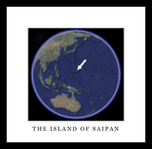
I leave for Saipan tomorrow.

Today we did our final ride, ride number 15 in 14 days. Today's ride was a nice and easy road climb up the hill from Santa Fe to the Ten Thousand Waves Spa. We deserve it, don't you think? Rou's wife Mary met us at the spa so she could enjoy it with us and also so we didn't have to ride home.

The ride turned out to be a really good uphill climb, as the spa sits on top of the ridge on the way up to the mountains from Santa Fe. We rode 16.6 miles, and climbed 1,460 feet in an hour and 13 minutes. It was a gradual climb for the most part, so we maintained a good pace.
What made it most enjoyable was the fact that as we were climbing up the road, the drivers of three separate cars honked and waved or gave us the thumbs up as they passed in the opposite direction. I can only assume they were fellow bikers trying to help us up the hill with their encouragement. I can't tell you how many times I've been honked at or yelled at in a negative way, just for riding along and minding my own business, so it was great to be riding in a city that's so biker-friendly.

The spa was amazing and can only be described as a little bit of Japan in New Mexico. They have private outdoor spas, so for an hour we had a small patio with a hot spa, a cold spa, and our own private dry sauna. It was strange, in a way, to see all the Japanese style in New Mexico, but it also felt a bit like my home back in Saipan. They even had my favorite Japanese chocolate covered bread-stick candies!

The Colorado Trail, Durango, CO

I woke up and, looking at the blue skies, decided to try and get in that ride on the Colorado Trail that was rained out our first time through Durango. What I didn’t realize looking out the Motel window was that it was 32 degrees outside. Oh well. I bundled up and went anyways. Rou was feeling a bit under the weather and had some work to catch up on anyways, so he dropped me off at the trailhead to the Colorado Trail and I rode back to the hotel from there.


The ride, though cold, was spectacular. It was a nice smooth hardpack trail that began with a long 2000 foot climb that I was expecting, so it wasn’t too bad.

About half way to the top there was a beautiful lookout and I found myself alone in a quiet beautiful pine and Aspen forest with the bright yellows of the aspens changing color. I realized that this must be why they call Colorado “Colorado”, which means “colorful” in Spanish.

I finished the climb and hooked back into the Colorado Trail after taking a side loop on Hoffeins Connect and Dry Fork Trail. The way down was fast and mostly smooth, with a few challenging sections but nothing too technical. Once I got past the “Gudy’s Rest” lookout, and started heading back down to the trailhead, I passed bikers, runners, hikers and dogs galore. Everyone was out enjoying this beautiful Sunday morning. I was glad I started early and had beaten everyone to the top and had a nice quiet climb to myself. I took the road back down to the hotel, showered up and we took off at noon for the 4 hour drive back to Santa Fe.

When we got back to the house in Santa Fe, Rou and Mary took the dogs for a walk at sunset. I stayed home and hopped in the hot tub on the back deck. As I sat there, the sun began to set and I realized how amazing and colorful the desert can be. This was my view:

When I looked at this picture on my computer, I thought I must have accidentally had the camera on "Underwater" mode because the reds were so vibrant. The camera wasn't on underwater mode; this is just how vibrant the colors are here.

Tomorrow is the day before I leave, and thus according to the pact of biking every day, we’re doing one last ride. This one is going to be a road climb up to a spa called Ten Thousand Waves where Rou’s wife Mary is going to meet us for a nice post-training celebration at the spa!

Saturday, October 13, 2007

Kessel's Run, Fruita, CO ... and back to Durango

We woke up, cooked up some bacon, egg and cheese burritos, and then I went for a quick 45-minute ride down Kessel’s Run and up Prime Cut while Rou packed up the tent. Along the trail I met a dad and his 10-yr old son riding in the opposite direction. One of the cool things about the riding we’ve done on this trip is that we’ve met men and women, skinny and big-boned, aged from 10-60+ all riding bikes on these amazing trails. And everybody has been friendly and willing to stop and chat to a fellow biker along the way. We’ve even exchanged emails with a number of folks at the end of rides.

We’re heading back towards Durango now, and may give the Colorado Trail a shot tomorrow if we’re feeling up to another three hour challenge. The scenic highway 550 south between Ridgeway, CO and Ouray, CO (the “Switzerland of America”) is an unbelievably gorgeous stretch of road through an aspen-yellow valley with horses grazing in fields of green grass on humble yet beautiful ranches.

The road winds slowly towards the jagged mountain peaks painted white with snow in the distance.


It got down to 34 degrees and started snowing as we went over some of the mountain passes. I hope the weather holds out for tomorrow's ride in Durango.

Friday, October 12, 2007

Porcupine Rim, Moab, UT

Today we woke up at 18 Roads campsite once again, ate a quick breakfast, got in the car and drove straight to Moab.


It took about twice the 45 minutes that someone told us it would… but we got there just in time to catch an 11:30 shuttle on “Coyote Shuttles” to the LBS (or something like that) trailhead. Our driver Christie was great and drew us a homemade map of the trail. We didn’t have any cash with us, and they don’t take credit cards, but she told us it was no problem and said to just leave her some cash at Slickrock Cycles when we got done. We got dropped at the entrance gate to the Manti-Lasal National Forest, rode about a half mile up the fire road, and then cut left onto a trail that led to the rim of the canyon. From there, we followed the canyon along one of the most beautifully scenic stretches of singletrack that I’ve ever ridden.

What made it difficult was choosing between looking at the unbelievable canyon views and concentrating on the intermittently technical sections of trail. Here are a few photos demonstrating what I mean when I say "technical":


The trail started as a narrow singletrack that followed the edge of the canyon, and then progressed to a narrow doubletrack that descended to the lower rolling hills. Just when I thought the views had subsided, the trail brought us to a bluff overlooking “Negro Bill Canyon”. We could see the trail snaking down below us and it took us right to the edge of the Canyon, once again turning back to singletrack. The last section of trail was moderately technical and really tested our concentration, skills, and weary bodies.

After all, this was our 11th day of riding in a row. Not every day has been a big ride, but we’ve done a lot of climbing and a lot of really technical descents, which are fairly taxing on both your body and mind. What made it even more frustrating was the constant stream of riders of all ages and shapes who descended effortlessly (on presumably fresh legs) and passed us by every time we stopped for any reason, whether it was to take in a view, a little food, or to make an adjustment on our bikes. We just decided to take it slow, enjoy the views and the ride and not push ourselves too hard.

It always seems like you are most likely to crash when you’re at the end of a ride and are tired and you are focusing on your sore body instead of the obstacles ahead.


We finished the trail section of the ride which quickly snaked down through the canyon with a few short portages over rocky sections. The end of the Porcupine Rim trail is actually on Highway 128 about 4 miles shy of Moab. We did a road-bike pace sprint (19-20mph) over the mostly flat road back to Moab, passing a big group of riders who had overtaken us on the trail. It’s a beautiful section of road along the Colorado River that passes a number of National Recreation Area camping sites.

We packed up our gear, and I bought a couple of stickers for my bike from the Poison Spider Bikes shop (they are the shop I rented from the first couple of times I had ever ridden Moab with my brother Mark and his friend Dave back in 1997). We grabbed well-earned beer, burgers, and fries at the crowded Moab Brewery (tomorrow is the big 24hours at Moab race), and headed back to camp at 18 Roads in Fruita.

When we got back to the now crowded campground, there were two tents set up next to ours at our campsite. Chris, Karen, and Kelly (a Beaver Creek Ski Patrol/EMT, a civil engineer, and a marketing guy, respectively) were from Vail, CO and ended up joining us around the campfire for some bike and life talk before we hit the sack for the night.

Thursday, October 11, 2007

Chutes & Ladders and Mary's Loop, Fruita, CO

We woke up this morning and after a quick breakfast hit the trail right away. We rode to the north trailhead and this time took Chutes & Ladders. In the photo it is the red loop on the right.


Chutes & Ladders started out with some fairly tough but short climbs (some you had to walk up) with fun narrow, steep, swoopy downhills with sudden sharp short uphills (hence the name). The terrain was a combo of hardpack and slickrock with desert shrubs. After coming out of the rolling hills, we descended into a vast flat plain with nothing but dried grasses and small cactus. The trail was a super fast, slightly downhill winding ribbon of singletrack that seemed to go on forever between the prairie dog mounds and skeletal remains of lost bovine creatures. As we careened along at full speed, I suddenly noticed something out of the ordinary… a deep ditch in across the trail which was uncrossable. I slammed on my brakes and came to a stop with my front tire teetering over the edge. As I thought about how this was definitely a collar bone-breaker, I heard Rou’s back tire skidding to a sliding stop, also just inches from the precipice. It was so close that his rear tire actually skimmed the heel of my left shoe as slid past me. We hooked back into Prime Cut trail, which wound us up and to the north back to the main trailhead. Along the way I experienced the unfortunate but all-too-familiar chainsuck, which not only "sucked" my chain up between my frame and front chainrings, but also managed to unfixably bend one of my chain links. I removed my chain, removed the bent link, and reconnected the chain during a short 15-minute trailside bike shop session.

At the top of the trailhead, we decided we hadn’t had enough yet, so we rode Kessel’s Run in the downhill North-South direction which was a rollercoaster-like 20 minutes of tight singletrack that wound up and down between the desert scrub brush. We took the gravel road back up to the campsite and called it quits…. until we went out for our second ride!

We ate a quick lunch at camp, then drove into downtown Fruita and gave our bikes a bath at the SingleTracks bike shop


while the amiable and attentive owner Chris added a new link to my chain to replace the one I had taken out on the trail. We were still hungry, so we had a 2nd lunch at Aspen Street coffee shop. From there we drove to the Kokopelli Trailhead in Loma, just west of Fruita on I-70. From the trailhead we rode Mary’s Loop in a clockwise direction.

This was definitely some of the most dramatic scenery we’ve seen so far on this trip. The trail wound around the rim of a canyon and we were surrounded by deep red slickrock outcroppings with sheer dropoffs to the valley below.


This is the view from Mary's Loop looking down on part of the Horsetheif Bench Loop trail.

The trail turned into a slickrock staircase that we rode up before winding down and around the valley to the cattleguard marking the entrance to the Horsetheif Bench trail.

The entrance to Horsetheif is a seemingly impossible to traverse field of boulders, although it is rumored that some bikers have made the descent (though none without having to put a foot down). So naturally, we walked.

Once we got to the rideable trail, we rode in a counter clockwise direction around the loop that takes you right back to the boulders guarding the trailhead. This was one trail that everybody we met had told us we had to ride. And it was well worth traversing the field of boulders for. It was a swoopy and intermittently technical ride that took about 45 minutes and included a bit of everything from slickrock, dried streambeds, hardpack, and technical descents and climbs to canyon views of the Colorado River below. Here's a video that Rou shot wearing the helmet-cam:


It was the type of trail that was mostly if not all rideable, and called for the occasional “mulligan”, which is when you get stuck on a fun section, back up 100 feet, and try again until you successfully navigate the obstacle. You know you’re having fun when you have to unclip from your pedals and you yell, “Wait! I can do that! Do over!” before going back and attempting it again. At one point we were doing a technical ascent up a sheer face of slickrock that I couldn’t get up and I tried it again and again until I finally made it up on the 4th try.

While we rode Horsetheif we met two riders from Golden and Boulder, CO who joined us for the rest of the ride. They were on a similar type of trip except that they were doing both Motocross and mountain biking.

They were pretty inspiring to ride with because despite their being 49 years old, they were very fast and good technical riders. In fact, they made such an impression that Rou and I made a pact at the end of the ride that shortly before my 50th birthday (I’m 34 and he’s 33) we’d come out and ride this trail again and hopefully be able to keep up with a couple of young bucks 15 years our junior.

The rest of the ride had a bit climbing but was dominated by fast descending and moderately technical double track that gave us the opportunity to get a few jumps in down the short rock ledges that protruded occasionally from the trail. I’m amazed at how much my technical riding has improved with my new bike. The bike really makes things like short bunny-hop drops off 1-2 foot ledges a breeze. We hit an intersection in the trail where we could choose between taking a fire road about two miles back to the trailhead, or a singletrack trail called Moore Fun that wound along the ridge before dropping down to the trailhead. Naturally we choose Moore Fun, but after about 20 minutes of a very technical climb that included a lot of walking, we decided that we might run out of light before getting off the singletrack.

As my brother’s wife can attest, it’s no fun to be stuck hiking out of a trail on singletrack at night with me. So I spared everyone and suggested we turn back. The trail was slightly more rideable in the downhill direction, but at that point we were so exhausted that anything mildly technical was getting increasingly difficult. So we took it easy on the way down, then rode the gravel road back to the trailhead, arriving just as the sky began to get dark. We grabbed a quick dinner at Fiesta Guadalajara, the only restaurant in town that’s open past 9pm, and went back to the campsite at 18 Roads.

Wednesday, October 10, 2007

Book Cliffs Trails, Fruita, CO

Today we woke up in Durango, and as it was raining, we decided not to ride the Colorado Trail as planned, but instead drove the 4 hours or so to Fruita, CO. On the way we passed over some beautiful terrain,
(
drove over impressive mountain passes,

and stopped at the really quaint little mountain town called Silverton, which was a Victorian mining town established in 1874.

So long as it’s not winter, you can take a narrow gauge train from Durango all the way to Silverton. I wouldn’t be surprised if Silverton has been the set for a number of Western movies, as one block parallel to the paved main road there is another all dirt “main” street that has very western mountain-town styled buildings that look like they they could be straight off a movie set in Hollywood. We stopped in the Avalanche CafĂ©, which is on the dirt side street, and enjoyed the cozy atmosphere, a wireless internet connection, and some hot chocolate and chai at the as-advertised 9,318 foot-high coffee shop before continuing on to Fruita.

I couldn't help but snap a picture of this pickup truck that was carrying a taxidermied bobcat attacking a wild boar. You don't see that everyday.


Once we got to Fruita, we stopped at Over the Edge bike shop which Rou had heard of on the internet, and enjoyed looking at their Ibis Mojo frames with rubberized paint as we got the scoop on the local trails. We drove out to the 18 Road “Book Cliffs” Area which is also known as the “North Fruita Desert Special Recreation Management Area”, set up camp, and got on our bikes for our first ride in Fruita.

We decided to start out on the double-black diamond trail called Zippety.


We rode up the dirt road to the north trailhead where Zippety started. It began with fun up and downs on dry deserty hardpack, with lots of hairpins and banked berms, then tunred into steep climbs with steep drops. We suddenly found ourselves riding along a gravely knife-edge ridge. At one point we came around a hairpin turn to the left with a 100+ foot sheer drop to the right.

[If the movie gets stuck at 2:47, just drag the marker past that point and it should start playing again.]
Then a minute later the trail itself took a sharp left turn and with a similar drop, which we descended only after playing rock paper scissors to see who would attempt it first. I won, and here's the video footage from my headcam:

We hooked into Kessel’s Run. After a few minutes of the gradual climb back to camp, we decided would be better run in the opposite direction. We got back to camp, cooked up some hot soup with Elk meat, ate wild boar sandwiches, and hit the sack.

Tuesday, October 9, 2007

Hermosa Creek Trail, Durango, CO

Yesterday we left Santa Fe and drove to beautiful Durango, CO.

The city lies along a beautiful river, the Animas, and after we checked into our Motel, we took the bikes out just after sunset and headed towards downtown Durango. We ended up cutting through a dog park and found a trail that followed the river quite a ways. As we rode back towards the city, we stumbled upon a large "skate park" that had ramps and jumps for skateboarders as well as what looked like big round dried out swimming pools for BMX-type bike tricks, full of bikers and skaters of course. Then along the river there was a big slalom course set up for white water kayaking. Everybody in town seems very earthy and outdoorsy... most are dressed in some kind of outdoor gear by brands like Mountain Hardware.


Durango has a very cool historic downtown, which looks like a typical mountain town you'd find anywhere out west.


But the city seems very large now and there is a lot of development on the fringes of the town with plenty of strip malls and big warehouse stores like Home Depot and Super Wal*Mart.


Today's ride was down the famous (to bikers) "Hermosa Creek Trail". The fun way to do the ride is to get a shuttle up to the ski resort, and then just bomb down the trail. We decided that in order to get the best training possible, we had better ride up the trail ourselves. [OK, I admit it, the shuttle service wasn't running.] We stopped in one of the local bike shops yesterday, which is the best way to get advice on local trails, and the guy there told us about a loop that includes part of the Hermosa Creek Trail, but is called the Jones-Pinkerton-Dutch Creek-Hermosa Creek Loop. He said it was better than riding the Hermosa Creek trail out-and-back as we were planning, so we took his advice. But we had no idea what we were in for!

We started out our ride at about 11am. As we were getting ready by the car, another biker rode by us and Rou asked him if he was finishing or just starting out. He said he was just starting out, and in typical biker fashion we started talking about the trail and others in the area and he ended up joining up with us for the ride. Craig was from Dekalb, Illinois, and had just quit his job and was thinking about moving out this way so was driving around the Southwest checking out different towns and biking everywhere he could. He started out with the disclaimer that he was on his 7th straight day of riding so he was pretty tired and would be riding slow. Of course, this was our 7th day straight of riding too. Little did we know at that point that he was actually a competitive cross-country racer who races in the Comp (just below pro) category. He was a very strong, we found out. Mostly because we spent a lot of time looking at his back during the ride.


As we started up the trail I said, "Well, the guy at the shop said to expect 3,000-3,500 feet of climbing, and I think it's mostly in the beginning, so let's take it easy. We have a lot of climbing up ahead!" I remember at one point being very hot, sweating very profusely, and breathing heavily on the high mountain air (we started at 7,750 feet elevation). I looked down at my computer and we had done only 800 feet of climbing! This was a very tough climb. It was a narrow singletrack and it was rocky. So you couldn't just sit back and spin the crank. You had to work. And as you avoid a rock with your front tire your back tire hits it and slows you down. We finally hit a nice downhill section at mile 1, but the right back up we went. Then at mile 2, down, and then back up. Then at mile 5, 6, 7, 7.5, 8, 8.5... etc etc... we went up and down no more than 12 times before we really hit any extended downhill section. We were all hot and tired, and not knowing what was ahead made it all that much more difficult.

Each time we started down, once of us would say, "I think that was the last climb." We literally said that throughout the ENTIRE ride. As you can see from the elevation chart,


it was up and down the whole way. The hardest part was that most of the uphill was actually unrideable. It's called hike-a-bike and let me tell you it's no fun. Most of the section between mile 2 and 5 was this way.


It was tough going, steep and rocky. To me, the trail just looked like it was overused. This is in a National Forest, and its a multi-use trail, which means that hikers, bikers, motocross motorcycles, ATV's, horses, and cows are all using the trails. Yes, we actually had to chase cattle off the trail on two occasions! But the result was a deeply rutted trail that has high berms on both sides, causing water runoff to flow down exacerbating the erosion.

I remember looking at my computer at 3 hours 42 minutes and we had NOT reached mile 9 of this 20-mile ride. I started to get a bit worried that we may have started out too late. But the good news was that according to the GPS and the topo map we had stopped to check, we were at the top and heading down! Then the downhill started. We started on our bikes and all ended up hiking DOWN! That's how steep, rocky, and rutted many sections of the trail were. We rode some of them, but at that point were so tired and frustrated that we just didn't want to risk a crash or injury this far into the trail. Rou actually ended up flying over his handlebars twice and got a bit banged up. Fortunately, the trail spared Craig and I from the same fate.


Luckily after a couple of miles it turned to rideable terrain once again and we even hit some really nice sections of everybody's favorite: fast, smooth winding singletrack. But even that was intermixed with really technical sections that required slowing down, sitting waaay back on your saddle and holding on tight. We even had a few stream crossings, which are always fun. But after this nice downhill came the up and down, once again, which lasted all the way to the end of the ride. As we neared the trailhead, we passed a number of real-life Colorado cowboys who were riding horses down the trail in cowboy hats, chaps, and all. Behind them the had a chain of 5 or 6 horses with saddlebags carrying gear. They told us they were 'hiking' in to camp and to go Elk hunting. At that point I decided that it was good that I have a bright orange bike! At this point all three of us had completely finished the water in our camelbaks, and we were not sure how much longer we had to go. The cowboys told us it was only 15-20 minutes farther to the campground, so up and down we went right up to the very end. In the end, we rode for 5 hours 20 minutes (4 hours of it actually moving), climbed 4,332 feet, our highest elevation was 10,320 feet, and we traveled only 19.89 miles!


Sore and tired, the three of us sat by the campsite we parked at, talked bikes and racing and munched on the fresh fruit we had in the car. Tomorrow we are going out early to ride the Colorado Trail here in Durango, then back to the motel for quick showers before checkout time and we're heading to Fruita and Grand Junction, CO, hopefully before dark so we can find a campsite.

Monday, October 8, 2007

South Boundary Trail, Taos, NM


Yesterday, October 7th, Rou and I rode the South Boundary Trail in the Carson National Forest in Taos, New Mexico. We woke up early in Santa Fe and hit the road (in the car) for the 1.5 hour drive up to Taos.

We got to the bike shop parking lot as the sun was just starting to come over the hills, which was a good thing because to my Saipan-thin blood, it was FREEZING out! We had arranged a shuttle with the bike shop, and there were two other riders who joined us for the van ride up to the trailhead. It took about an hour in the van to get up to the trailhead which started at around 9,400 feet. As we arrived, the driver jokingly said, "The weather is perfect... to bad the colors couldn't be better." He was referring to the Aspens that were nearly at their peak of changing color.


The bright yellow trees were all around us. After getting everything adjusted off we started on what was to be a 25-mile, 4.5 hour adventure down the mountain back to Taos.

This ride is described as being "mostly downhill" but we quickly learned that mostly is a relative term. The first section was a narrow singletrack that slowly wound up to 11,000 feet ... and by the time we finished we ended up climbing 2,910 feet.


It was a hard way to start out, especially when your lungs aren't adjusted to the altitude yet.

But we knew the rewards were coming shortly! From the top of the trail,


we began the first descent, and it was all singletrack the rest of the way down.

We wound our way down through a pine forest which turned into a mixed pine and yellow Aspen forest, and eventually climbed back up to another peak where we had a beautiful 360 degree view. From there we had a nice long section of singletrack through the Apen and pine forest. The trail was clinging to the narrow edge of the mountainside and weaved carefully between the trees. There were some very fast sections with a lot of ups and downs where you could keep your speed up by pedaling a bit here and there...but you had to be careful because the trail was narrow and there wasn't much room for mistakes. To make it even more fun, every few miles we would encounter a large tree across the trail that had sticks stacked up on either side so the skilled riders could navigate over it without getting off the bike. Here's Rou deciding whether or not to navigate over one...


After an energy bar snack in a beautiful grove of Aspens, we continued on to what was to be the hardest section of trail that I have ever ridden in my life, and it really tested the limits of my riding skills, my concentration, and me new bike. But they all pulled through in the end! The last leg of the trail was a 45-minute ride down what can only be described as a rock staircase on a cliff. The trail was ridable for 25 meters at a time, then you had to sit WAY back in your saddle, hold your breath, and steer through the least dangerous section of rocks and you went down... down.... down the rocky trail. To put it in some perspective, all four of us were very experienced riders... and all four of us went down at least once on this trail. It was tough, challenging, and a blast in the end! We all survived uninjured and just a little bit bruised. All of our bikes got nice new scratches that will remind us of our epic ride down the South Boundary Trail. This was the perfect time of year to ride it... it was a little cool out but not too cold once the sun came out, and the Aspens changing color made it all that much more memorable.

Almost as memorable was our dinner that night. Rou and his wife Mary have a friend who is a professional chef. The chef Jean Luc and his wife Denise had us over for a dinner party at their house where he served among other delicacies, Wild Boar and Quail with Mole sauce served with tortillas. We ate outside in the chilly desert night air next to a mexican ceramic fire pit that was throwing sparks into the starry sky... My home in Saipan feels very far away right now!